Photo ↑ by @stefanhefele
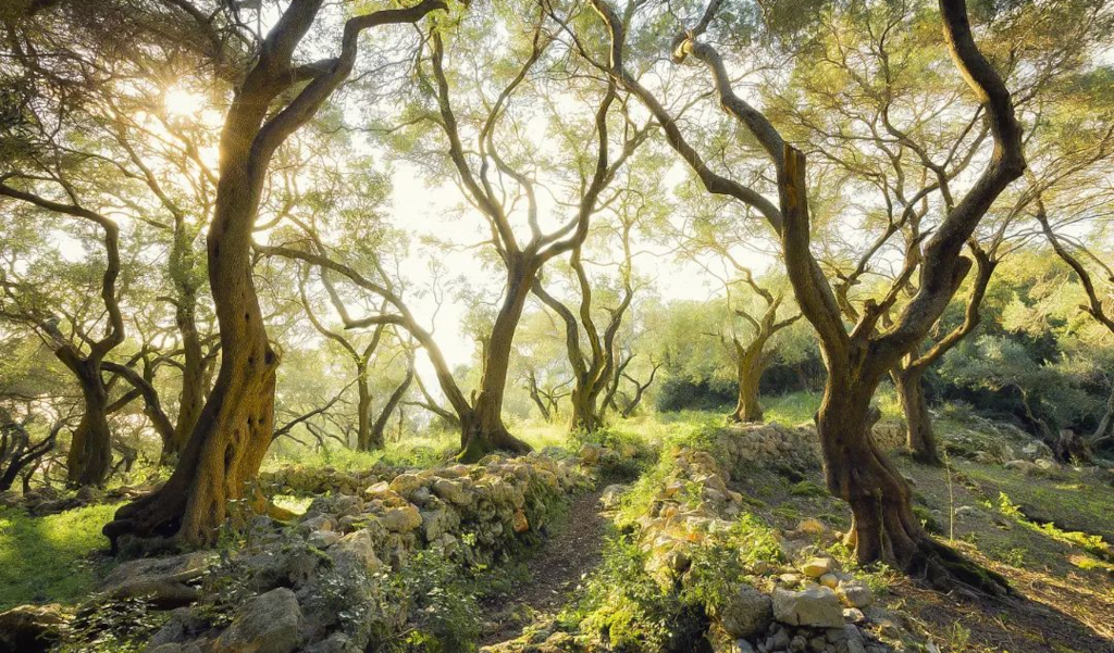
Walking in Corfu and in Greece in general isn’t like in other countries. For example, there are countries in Western Europe where paths are clearly defined. There are public paths, as well as paths marked on most navigation systems.
In Corfu, if you choose to walk over a field, you might be trespassing. From this point of view, while walking in the wilderness could be an exciting adventure in such a natural environment, walkers and hikers must pay attention.
Walks in this article often include public streets and roads, just to avoid confusion and problems.
What To Know Before Walking Or Hiking In Corfu
There are a few unwritten rules to take into consideration.
- If you see signs claiming it’s private property, avoid it. In Greek, signs may say ΙΔΙΩΤΙΚΟΣ or ιδιωτικός.
- Summer isn’t a good time to hike due to the extreme temperatures and life-threatening risks. Spring and autumn are much better.
- The emergency number in Greece is 112.
- You should have hiking boots, trousers, a hat, sunscreen, a small first aid kit, a torch and water.
- If you can, you should have a smartphone for navigation and orientation, as well as a fully charged mobile device for emergencies. You never know. Navigation will drain the battery of the smartphone, hence the necessity of another device.
- It may not be a good idea to walk or hike alone. It’s much better to be with someone else when facing a potentially dangerous situation.
- Avoid fires. Smoking and camp fires are a terrible idea. Greece struggles with vegetation fires every year. You risk killing someone. Penalties are extremely harsh as well and may lead to many years in prison.
Now that you know the basics, here are some of the shortest walks you can have around Corfu.
Angelokastro Krini Walk
This is one of the shortest walks around Corfu. It should take around half an hour to an hour. It depends on your pace and how often you stop on the way. If you rent a car, park somewhere in Krini. You can also find parking by Angelokastro, but parking too close will eliminate the necessity of a walk.
From Krini, take the road going down Angelokastro. There are two options if you look at your navigation system. Both of them work. At some point, while walking on the road, you’ll reach a hairpin turn or better said, a junction.
You can follow the road to the official parking lot or simply take a path through the wild. It’s not a risky path, as you only save about a minute. However, based on when you do this walk, it might be covered in vegetation. If not sure, stick to the main road.
Once in the parking lot, follow the path to the castle at the top. Stop there, have a picnic and enjoy the view.
Click here for directions on Google Maps and here for directions on DuckDuckGo, which uses Apple Maps.
Lakones To Paleokastritsa Walk
This route starts in a beautiful village with many facilities, so you might as well stop there for a coffee and breakfast before setting off. There are more options for this walk and they may vary from one season to another, depending on vegetation. In the worst case scenario, stick to the main roads.
On average, you can do this walk in about an hour or just over an hour. It starts at the central square in Lakones, at the viewpoint. From the main square, start going downhill. If you’re not sure where to start, set the destination to Agios Spiridon Beach in Paleokastritsa in the navigation system.
Set the system to walking and it should show you where to turn. Most people use Google Maps for its convenience, but there are other options too. Apple Maps will also take you to the destination, but on a different route. Both are alright for this walk, yet Apple’s walk is more popular.
You’ll go down a dirt road, as well as an old cobblestone road. This is the best part of the walk. The road will go back to a dirt track, but it’s well tarmacked as you prepare to get into Paleokastritsa. Take the camera out and snap a few photos before going down the parking lot.
Once there, you can have something to eat or drink, but also chill on the beach for a while. You’ll have to go back the same way or perhaps use a different navigation system to change the route.
Click here for directions on Google Maps and here for directions on DuckDuckGo, which uses Apple Maps.
Erimitis Loop Walk
This walk is ideal if you hate coming back the same way. It’s a loop, so there’s always something new to explore. Besides, it gives you access to the unique ecosystem of Erimitis, one of the most impressive biospheres in the whole of Greece.
At only a couple of kilometres in length, this is the type of walk you’ll complete in about an hour.
Start at Paralia Avlaki, where the road bends. On one side, you have the beach. On the other hand, you have Savoura Pond. Go towards the northeast along the coast until you reach Avlaki East Beach. The path, which is also available on Google Maps, turns right.
Keep going until you merge into another path and when you reach what looks like a T-junction, turn right. You’ll then head towards Arias Beach, which is accessible through a separate route off the one you’re already on.
At some point, at the fork, keep right. Eventually, you’ll reach a main road. Turn right and you’ll get back to where you started. Based on the paths available on Google Maps, you can also extend the loop if you want.
Click here for directions on Google Maps.
Gastouri Scenic Loop Walk
This loop walk around Gastouri covers around two kilometres and takes just over an hour. It’s an easy walk, suitable for people of all fitness conditions. Like for other walks in this article, names and points are based on what you can find on Google Maps, so organization shouldn’t be too difficult.
Start at the Holy Church of Agia Kyriaki and walk towards the Old Mill Ruins. Keep following the route and keep the Ekaterini Estate on your right. You may not see it, but if you look on Google Maps, it’s there. Keep going towards Elia Taverna Grill House, also available on Google Maps.
Once you get to that junction, cross it and keep going the same way. Soon after you pass it, on your left, there’s a path with quite a few signs. Go that way and follow it. Eventually, you’ll end up crossing the same main road again.
Keep going forward on paths, around the main road. You can also take the main road if you feel like it.
Get to the Church of Panagia Odigitria, then go in the same direction on a path until you reach a road. Turn left and after a minute, turn left on the main road again. Go over the bend and look for a sharp right path. Take it, go straight and you’ll go back to a different main road.
Turn right and you’ll get back to the Holy Church of Agia Kyriaki.
Click here for directions on Google Maps.
Erimitis Beach Walk
Get ready to explore the beautiful beaches in Erimitis over a nice walk that may take up to two hours, especially if you stop for a picnic as well.
Start at Paralia Avlaki or Avlaki Beach, keep Savoura Pond on your right and head east. Turn right at Avlaki East Beach or better said, just follow the path. When you reach a T-junction of paths, go right. Arias Beach will be on your left. Go take a look, then go back to the main path.
Keep left at the fork and follow the Akoli Beach. At this point, Akoli Pond should be on your right and the beach on your left. Follow all the way to Vromolimni Beach, with the pond of the same name on your right.
Your next stop is by Cape Agios Stefanos, go round it towards the sea and then follow the road and stop when you reach the main road. The end is in the Agios Stefanos Harbour. You can go all the way back, just put Paralia Avlaki or Avlaki Beach on Google Maps and it’ll take you there on a different route.
Going back will add less than an hour to your walk, so it pays off having something to eat and drink in the bay before setting off.
Click here for directions on Google Maps.
Stavros Loop Walk
With about 4.5 kilometres in length, this circular walk shouldn’t take more than two hours to complete. There are a few hiking areas, but overall, it’s doable for any level of fitness or experience.
Start in Dafnata, at a junction of a few different roads. Put Komianata on Google Maps and follow south. Once there, your next stop is a chapel. Use the link below or simply copy and paste Ιερός Ναός Σωτήρος in Google Maps.
From that point on, walk back to Dafnata, but make sure you take the parallel route. You’ll go back to the same place, but along a different route.
Click here for directions on Google Maps.
Bottom line, as you can see, most walks can be easily done with Google Maps. Some of them have links to the DuckDuckGo maps, which basically rely on Apple Maps. Google Maps simply has more locations, so setting an itinerary is much easier.
Also, you may have issues with the reception at times, so try to put all the destinations or stopping points in the navigation system before you set off.